4 November 2017
The sun is out. The beautifully adorned town of Bright is basking in the sunlight and tourists are out in force, almost more leisure bikes than cars. Bright is in its element in this spring weather, presenting its gentle weaving of stunning European deciduous trees and the rugged hardiness of Australian natives. I’m back in the Victorian Alps to give the high country a bit of a shot. And this time it is Falls Creek. As I head out from Bright, I consider the need to adopt the local reference to Falls Creek and so, as we tend to do by shortening words in a bid for familiarity and affection, ie., Wagga and Maccas and trackies, I propose to refer to Falls Creek simply as ‘Falls’. I’m off to Falls.


I pedal off, easily now, along the Great Alpine Rd out of Bright, it’s a flat road and the trees speckle the light. There’s a slight, spring breeze just chilling the air enough to let me know that I’m off to the high country; it has me wondering if I’m going to need a jacket-layer over my shirt. Then I’m alongside the pine plantation and the warmth from the sun takes my mind off feeling any cold. This part out of Bright is nice and even and so I increase the pace a little. I am feeling pretty darn good – mind you, I’m only two or three kilometres out of Bright. But you do get a feeling, sort of like a plan coming together, that it might be a strong riding day…a good day for attacking the alps. The pine trees from the plantation are much bigger along the road here than I remember, which, although it make sense, I do recall this road being more open spaced paddocks and less shrouded by trees. As I turn off the Great Alpine Rd and onto Tawonga Gap Rd, I think of a couple of things; I remember that I have some tough climbs to come today and I wonder at why Germantown is called Germantown. Obviously some deeply significant thinking happening today.
I’ve ridden up Tawonga Gap from the Bright side a number of times and I’m always surprised at the increase in angle as I gain height. And I know that this hill is just long enough to keep me wondering as to which bend is finally going to be the last. I pass a couple of warning signs, one of which has a creatively converted kangaroo using a ski theme, right down to a ski hat! Who is so committed to subversively artistic moments of humour that last for only a quick chuckle that, in such an opportune moment, they stop their car, grab their only subversive tool (the ever-enduring electrical tape), jump out and add the insurrectionary flourish to such a sign? That is commitment! I should think about something with greater depth, but I pass another sign, further along, that is aimed at reminding motorists that ‘Cyclists share the road’. “Now, I’m safe!”, I think, because, after all, I”m in a ‘High Risk Area’, and that sign will no doubt help. But I consider that, should anything happen to me on this road, at least now I have the sign to back me up.


The road begins to rise and I pass a few cyclists coming down, looking fresh, the way you do when you’ve spent 15 minutes or so descending. I give the ‘nod’ of the head and mouth a ‘hey’ that forms the universal cyclist greeting – and I’m riding up alongside some amazing walnut groves. These trees are great reminders of trees flourishing on their own, trees that haven’t had to compete for light and space and, therefore, trees that can just spread their branches grandly and wherever they choose. Not all trees get that opportunity.


The shoulder of the road is a little too patchy for my liking and I move more onto the lane of the road – this is always the balance in road cycling; to be a good road citizen and stay off as much as possible versus taking up enough space so motorists can see you. Still rising, I reach the cutting that signifies the beginning of the hardest part of the climb and, as I pass a sign for German Creek, I sort of find out the reason, perhaps, for Germantown…maybe. But of course now I’m wondering why German Creek is called German Creek…this kind of thing, as many parents would substantiate, can be never ending. Pushing questions to the back of my mind, I pedal on and up.
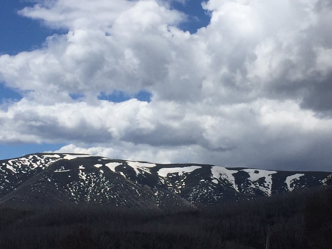
The Tawonga Gap road winds into itself and any evidence of a ‘gap’ is difficult to find; so the climb continues. The road bends, twists and often promises an end. It is similar in look and feel to the Kinglake ride from St Andrews, which I ride reasonably often. The foliage is similar and has the same constant rise of about 7%. I manage to turn the last bend that gives an ever so slight glimpse of the top and I see the gap. I pick up the pace, as you can do when an ending is in sight. I reach the top and pause for the briefest of spectacular views of the Kiewa Valley and across the valley to distant Mt Bogong on the other side, still capped in snow.


This is the fastest I’ve completed this climb – the 5.8 km to the gap, according to Strava, is a category 2 climb and has taken me just over 30 minutes at 7% (averaging 11.6 kmh). Even better, I feel pretty good and confidently ready for the ascent of Falls.
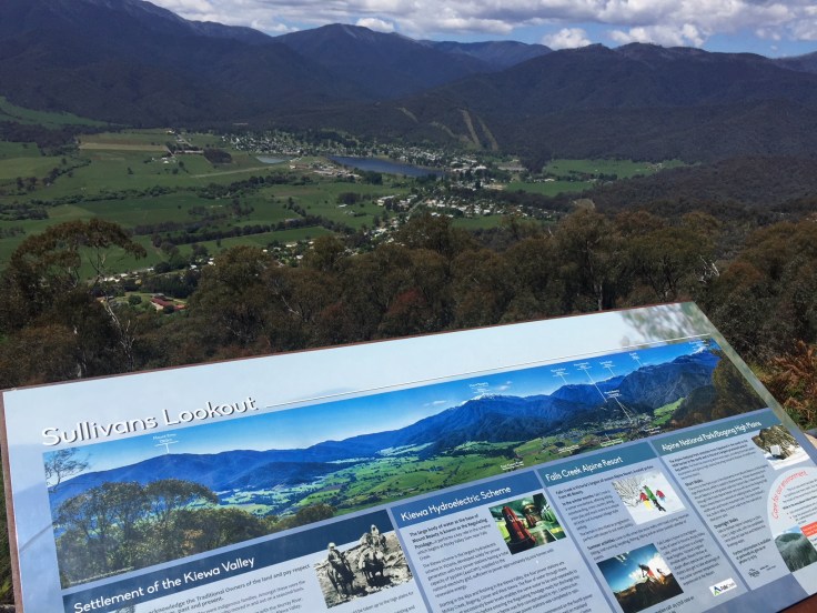
I think the idea of descending on a bike is over-romanticised. There’s this sense that descending should be like taking your feet off the pedals and head down, yelling “WEEEEE” all the way. As I head down the Mt Beauty side of the Tawonga Gap, I need to constantly brake – and hard – and my hands only squeeze so much on those brakes. The breeze is now drying cold sweat, chilling my face, head and shirt. There are plenty of hairpin bends and steep curves. It’s not all “WEEEEE” – there’s like this brief moment when you start and then it’s hold on! Sullivan’s Lookout is worth a stop, if I can brake and actually stop. The spectacle that pans out before me is stunning. The panorama takes in Mt Beauty in the valley and the mountains that stretch on indefinitely as a backdrop. A glance south-east gives me a vague idea of where I’m heading beyond.
I slow and stop and then I’m off again, juggling how far I have on the edge of the road with cars moving up behind me, at one stage almost moving into the gravel as an overly-aggressive tailgater doesn’t realise that the gravel is not good for a speeding bicycle. “Cyclists share the road – I’ve seen the sign!”, I want to yell out, but I don’t. Instead I just wobble on the edge and the car goes past. I recall this stretch is where, many years ago on a family trip to Mt Beauty, we came across a wombat crossing the road at night. It was here that my very young daughter profoundly concluded that wombats bear similar characteristics to her father and, being someone who didn’t necessarily understand the need to be subtle, said that “Daddy is even slower than this wombat”. Kids, hey?
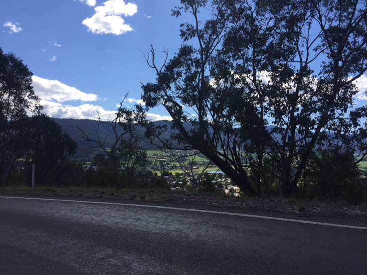
I reach the bottom of the Tawonga Gap Rd and turn into the Kiewa Valley Highway. As I do, I see a massive peloton of riders heading toward me and I feel intimidated. I move to the edge of the road and try to look like I’m just out for a leisurely ride in the park but when I look back they’ve disappeared. Whew! A bunch of riders bearing down on you is a very imposing site. I suspect they’ve sensibly turned to go up the Tawonga Gap. I relax and head though Tawonga. As I do, I notice a sign indicating the Bogong Moth Motel up ahead. Really? Someone has named their motel after a moth? I realise that this must be a tribute to the huge, local hero of the region, but is anyone likely to want to stop over for the night at the ‘Bogong Moth’? Obviously people do; it’s still here and I’m sure it is a very nice motel. I keep going, dropping down, and head into Mt Beauty and stop for the super-food of choice, a banana. The clouds are out and the breeze is a little chilly now. I text Kaye, who is likely to be heading off as support vehicle soon, to suggest she bring me a jacket for the way down. I can’t imagine it is any warmer higher up.
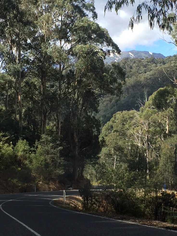
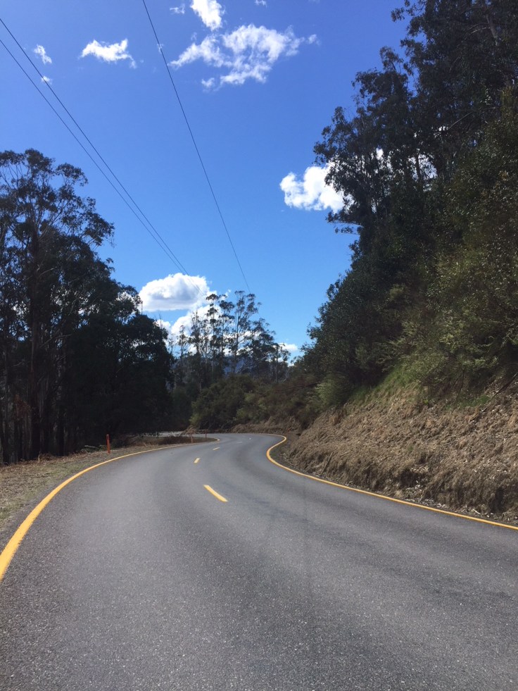
I head off for Falls, testing out the idea of familiarity in my mind – “I’ve just been to Falls…hanging out in Falls…ridden up Falls” – and settle into a rhythm. As I look up ahead, there is no clear sense of where I’m heading. In my past mountain rides, I’ve been able to at least glimpse where I’m going, but Falls (rolls off the tongue now!) is different. It is mysterious and hidden – more like a destination than a mountain top. I wonder, since this blog is about cycling and life, just what life lessons there are in heading uphill for a destination that you know is there, yet have no clear indication as to where, except that you vaguely have an idea that the road winds on to get you there. I remember listening to a lecture many years ago where the presenter used the ideas of a philosopher, of whom I had never heard, to think about how we learn. The philosopher raised the question as to how we find out about things in life, the nature of which we don’t even know exist. It is an interesting thought that has prompted me to get my own students to contemplate at various times – this is a little of what education is and one of the challenging things about life. I think there’s a bit of faith in that, too – testing and trying out and exposure to ideas the nature of which are not clear or understandable. Mmm… Still, the ride continues and I pass a sign that shows the distance to go as 30 km – this is going to be a long ride. Climbing out of Mt Beauty, the road seems to ascend in steppes and before too long, I’m looking back down into the shades of green that make up the picturesque Kiewa Valley. I’m feeling good – I have just had a banana, I remind myself – but it doesn’t seem as steep as I had previously thought.
I keep on with the grinding rhythm – more grind than rhythm, though. Some downhill and more grinding. I reach the u-turn at Big Hill Rd and there’s a false flat that gives my legs a brief reprieve. I’ve completed the Cranky Charlie climb, the 4 km from Mt Beauty at 5%. I calculate, in some incredibly miraculous way with some spare space in my brain, that I’ve still got 26 kms to go. My mathematics is amazing! I give a long, slow puff and follow the road slightly downwards before it rises again. The climb to Bogong Village is relatively good – there are a couple of downward slides, but mostly, when I lose ground the gradient increases for the next climb. I can see the snow on the hills to the left and the road keeps winding back to face what I assume is Mt Bogong.
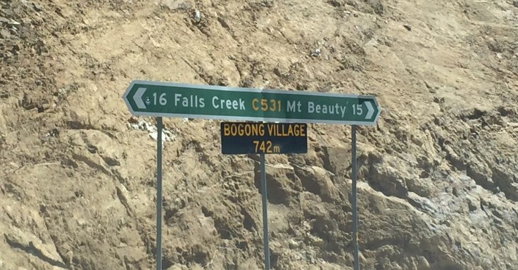
Another cyclist passes me. He is really powering up this part of the road and he has left me behind before I know it. I like to think that he drove to Mt Beauty and started from there, but somehow he looks too complete a rider to have done that – he seems so controlled, as I wander away and back from the side of the road. I make it to Bogong Village and realise this is about the half way point. It’s taken me just under an hour and so I’m pretty pleased with that but realise this is the easy part, having risen about 400 metres in that 15 km. Bogong Village looks quaint, but I admire it from above – the drop down to the town looks too steep and I’ve got another 15 or 16 kms to go.
There’s a nice drop to the East Kiewa River crossing and I pass some cyclists coming the other way – a nod and a ‘hey’ – they’re looking pretty tired.


I fly across the river, barely able to see the splashing water and mosaic of dappled rocks, before I commence the massive part of the climb. I’m feeling the pinch in my legs now – the Tawonga Gap ‘personal record’ obviously now catching up with me. It is back into grinding from this point yet again. I had been reflecting recently that parenting and teaching, like cycling, is mostly about the daily grind, with occasional glimpses of grandeur – there are some special moments that come along and give the necessary boost like adrenaline to keep going, but mostly it is a grindingly hard ride. The gradient increases, my pace slows, my legs tire further. I begin to emerge from the taller trees and into the scratchy, rocky, snow-blown scrub.
I see the snake in the middle of the road before it sees me. It is difficult to identify – a piece of bark on the road? I swerve to the left, heart suddenly beating faster. A long, but skinny brown snake, basking in the sun, seeking whatever warmth it can gather from the bitumen road. I quickly identify it as a Brown Snake – a tough one – just in case it rears up and challenges me for my side of the road. Whilst it seems to notice something, it is not a Cobra and retreats – I like to think it ‘slinks’ (past tense of which should be ‘slunk’) – quickly off to the right, but is reluctant, as I glance back, to lose the warmth completely and stays at the edge of the road. Not only has my heart and adrenaline quickened in the excitement, but my cadence and speed is up. I settle back down, a little glad to have something to distract me from the developing aches in my legs, but aware that I need to get back to the rhythm of this gradient.
I reach the turn back, as it is called, and once I’m around and up that, the grade levels slightly. I’m tiring now but reach the Resort Ticket booth and continue to climb.
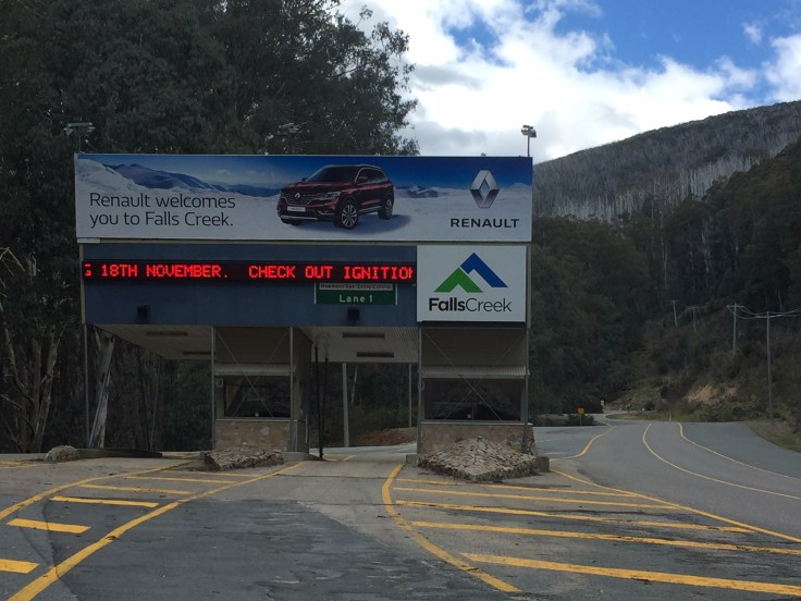 The clouds are accumulating, clearly not as much space between them and the mountain as further down and it’s getting colder. I’m pleased now because, although my legs are pretty much at their limit, I’ve only another 4 or 5 kilometres to ride. I ride through Lane 1, since that makes me feel like I’ve achieved something, but there’s no one there to notice, so I don’t raise my arms in any victory salute. I couldn’t anyway, without falling off. Funny thing about your mind – it starts to rationally argue against itself. If I’ve got 5 kms to go and I’m doing about 10 kmh…Oh, no! That’s another half an hour of riding…I don’t think I can ride for another half an hour like this…but…imagine if you went slower. 5 km at 8 kmh…Noooo! See what I’m saying? It is a mental battle almost as much as a physical one. But I realise that it is only me here and all this is relative to what I have chosen to do in riding up a mountain – I recognise that there are a bunch of other people who do some tough mental stuff above and beyond my little venture. Still, it has benefits for me in plenty of other applications. This is about stamina, persistence and mental toughness. Grind, grind, grind. I take a sip of water – the only other purposeful point of distraction.


The trees seem blasted here, like they’ve survived the winter, but only just. There’s snow in the nearby hills and it is getting quite cold. The last 4 kms takes me about 22 minutes. It is at 7% gradient and was one of the toughest parts of the climb, particularly after 26 previous kilometres of climbing. The last 700 metres took me nearly 5 mins!


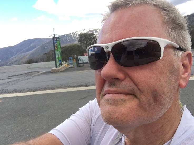
I made it. That’s the only way to record this achievement, this massive climb. I get off my bike and hobble to a nearby seat. I can feel the cold in the air getting inside my head and clothes already, despite having just stopped. My legs can’t seem to stop shaking but I made it…just…


The Falls Creek ride, according to Strava’s segment, begins just out of Mt Beauty and finishes just at the entry into the Falls Creek Village. It is classed as a high category climb – 29.5 km at 4%, ascending 1154 metres. I managed to complete this in 2:05:24, averaging 14.1 kmh. But really, I was just pleased to have made it.
Once again, cool road and scenery photos, super support and unassuming publicity by Kaye!
Post Script (for clarity): – I ended up descending, quite kapoopted, and made it to Tawonga before my legs and phone both ran out of energy. Kaye, in the support vehicle picked me up (just near the Bogong Moth Motel, incidentally). The ride covered 95.5 kms, took me 4:33:27, averaging 21 kmh. I ascended 2,384 metres, the most height I’ve achieved in a single ride…ever.

Leave a comment